
Our Services
Precision mapping and spatial insights tailored for your projects.
Drone Surveying
Professional drone survey services for high-resolution aerial mapping, topographic surveys, progress monitoring, and accurate geospatial data collection for diverse infrastructure and land development projects.


2D/3D GIS Digitization
2D and 3D GIS digitization services for accurate conversion of maps, drawings, and spatial data into intelligent digital geospatial databases for analysis and infrastructure managemen
Image data processing services for orthomosaic generation, feature extraction, classification, and high-quality geospatial analysis using drone, satellite, and aerial imagery.
Image Data Processing


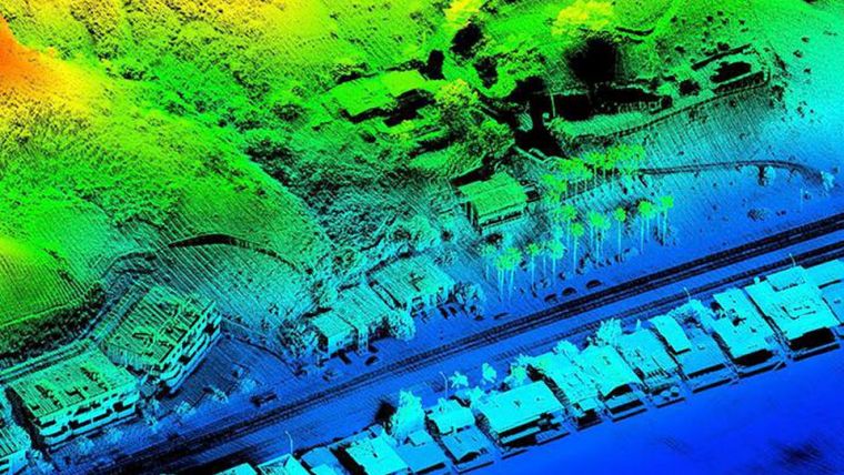
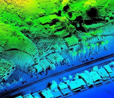
LiDAR Surveying
Advanced LiDAR survey services for high-accuracy terrain mapping, corridor analysis, 3D point cloud generation, and detailed geospatial data extraction for infrastructure and engineering projects.

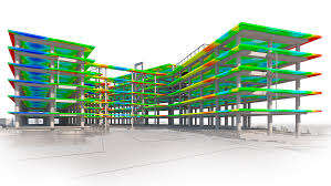


BIM Services
DGPS Survey
Comprehensive BIM services for 3D modeling, design coordination, and infrastructure lifecycle management. Capabilities include Modeling, Architectural, Structural and MEP BIM, Clash Detection, Scan-to-BIM, Point Cloud to BIM Conversion, and GeoBIM Integration.
High-precision DGPS survey services for accurate positioning, control point establishment, topographic mapping, and geospatial data collection across infrastructure and land development projects.
Other Services...
Solar Panels Inspection
Advanced drone-based solar panel inspection services to help identify hotspots, damaged modules, shading issues, and performance inefficiencies with high accuracy. Using thermal imaging and geospatial analytics, we enable faster maintenance decisions, reduced downtime, and improved energy efficiency for solar power projects.


Mining Survey
Drone-based mining survey services for accurate volumetric analysis, stockpile measurement, terrain mapping, and mine progress monitoring. Our high-resolution aerial data and geospatial solutions help mining companies improve operational efficiency, safety, and project planning.
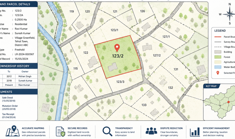
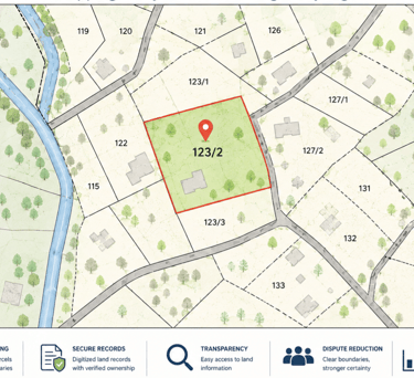
Cadastral & Land Records Mapping
Cadastral mapping and land record digitization services for accurate parcel boundary identification, ownership mapping, and spatial database creation. Our GIS-enabled solutions support land administration, urban planning, infrastructure development, and efficient management of revenue records.
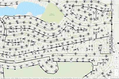
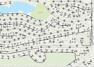
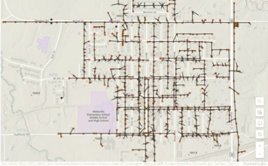
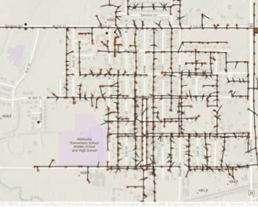
Utility Network Mapping
Utility network mapping services for water, gas, sewer, and electricity networks using GIS and geospatial technologies to enable accurate asset mapping, efficient infrastructure management, and improved operational planning.


Telecom Capabilities
Telecom engineering solutions including fiber route optimization (HLD), fiber distribution design (LLD), intelligent route planning, network architecture design, splitter connectivity planning, permit drawings (County, City, DOT, TCP), vicinity maps, BOM/BOQ preparation, and scalable telecom infrastructure planning to support efficient, deployment-ready fiber network implementation.
Contact
Reach out for inquiries or project details.
Phone
+91-9000345485
© 2026. All rights reserved.